
~Noyna Ramble~
21st April 2010
On a day like this it would have been a shame to get back from work and retire into an armchair for the evening. The air was clear, the winds light and the progress of Spring is now well underway....
Noyna End
Scroll down for photos and a description of the walk
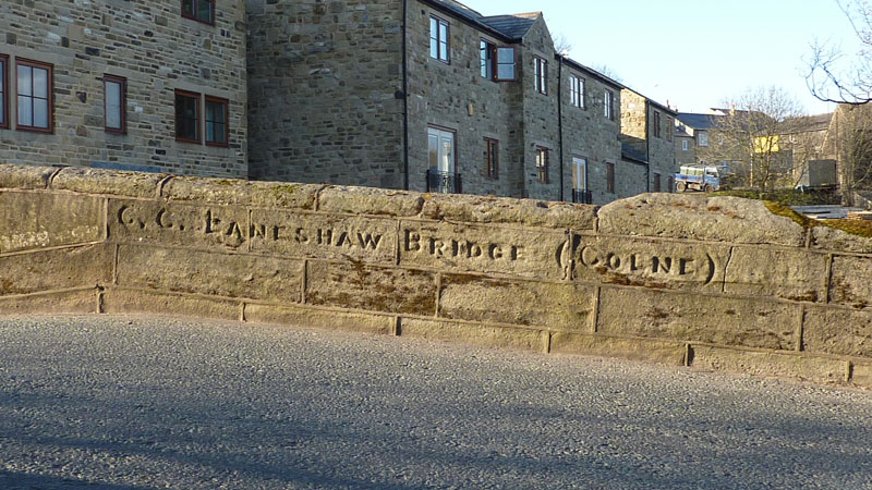
Laneshaw Bridge
Laneshawbridge is a small village in the far reaches of East Lancashire, generally written as one word, but shown here on the bridge as two and on my map as two. Apparently there are records of a bridge here, on the road to Howarth since 1566. I parked close to this bridge and set off on some new routes.
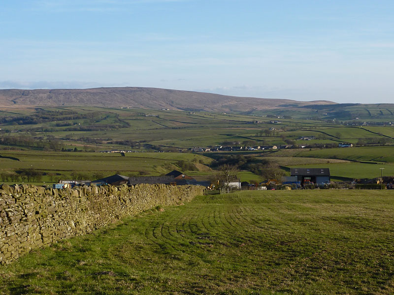
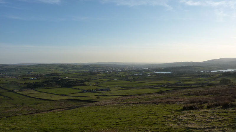
The way ahead, straight into fields after crossing the A6068, the hill on the horizon is on my route.
Boulsworth Hill
My walk started in the dip where you can see a few houses and I'm looking back at Boulsworth Hill.
Shaw Gate Farm
It's one of those farms where the footpath goes straight through the middle of the yard and you fear being attacked by man or dog. However a friendly farmer guided me in the right direction, I think it helps if you have a map in hand. From here it was over the back road to Skipton, past Flass Bent Farm and onto Great Edge.
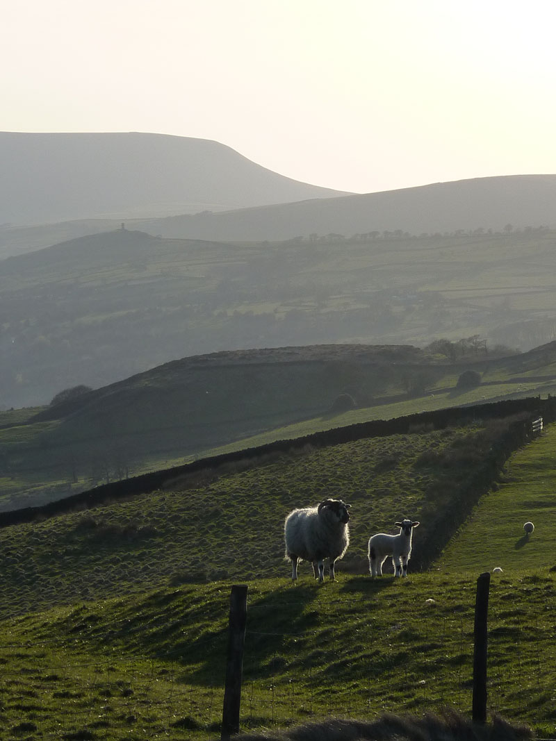
Sheep, Pendle Hill & Blacko Tower
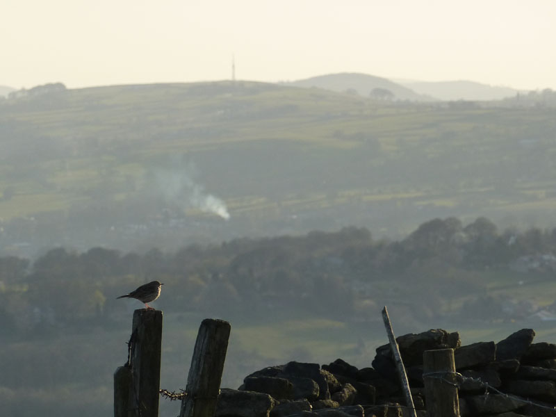
Bird - A Meadow Pipit?
I am now up at the highest point of the walk at about 1100 ft asl. Up here on Great Edge (sounds much more dramatic than it is) there is a hole in the ground.
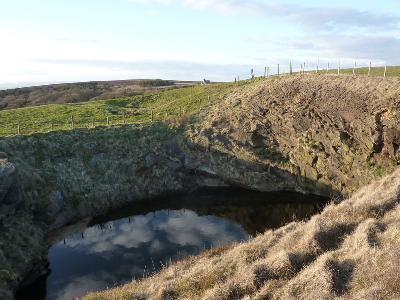
The Hole
Presumably some sort of quarry, but a little unusual as it is near the top of the hill and has no obvious route in or out. Why isn't it full of water?
Colne
The town of Colne is in view along with the Foulridge Reservoirs, which supply the Leeds & Liverpool Canal.
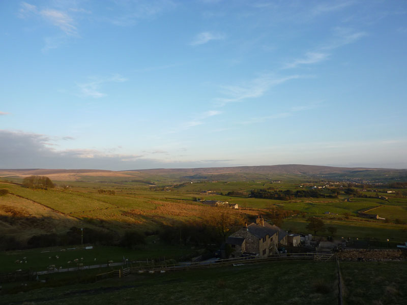
Noyna End
I have now reached the area I most wanted to take a look at. Noyna is a small area to the North of Colne, one which I've seen and driven close to, but never walked in. Noyna End farm is seen here with Boulsworth Hill in the background.
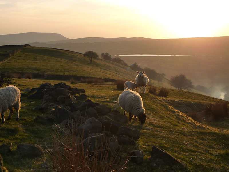
Sheep, Pendle Hill and Whitemoor Reservoir
Now I'm on Noyna Hill, home to Noyna Rocks (not in view) and I will descend next to the rocks and make my way to Noyna Bottom.
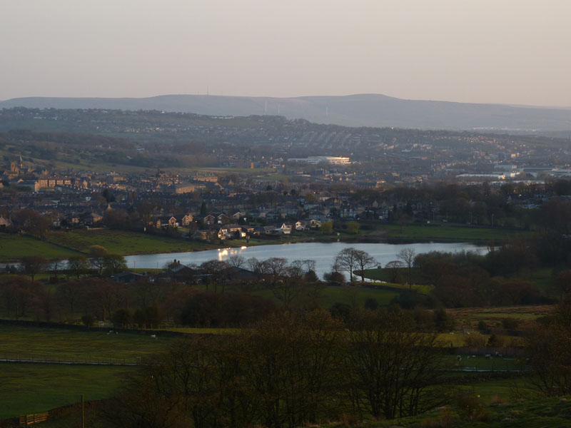
Upper Foulridge Reservoir
Colne Town Hall is just in shot on the left-hand side. The bright white building is one of the regions new schools, Hamledon Hill is in the backgorund.
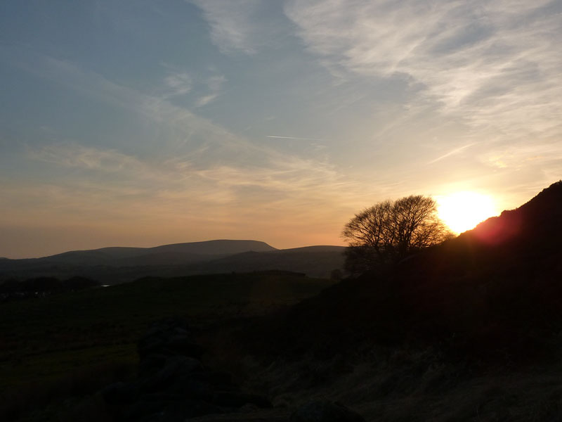
The Sunset
The location here is at Noyna Rocks, but the light and my position were not condusive to taking a photo of these rocks, you need to be further away. They form a typical Pennine outcrop.
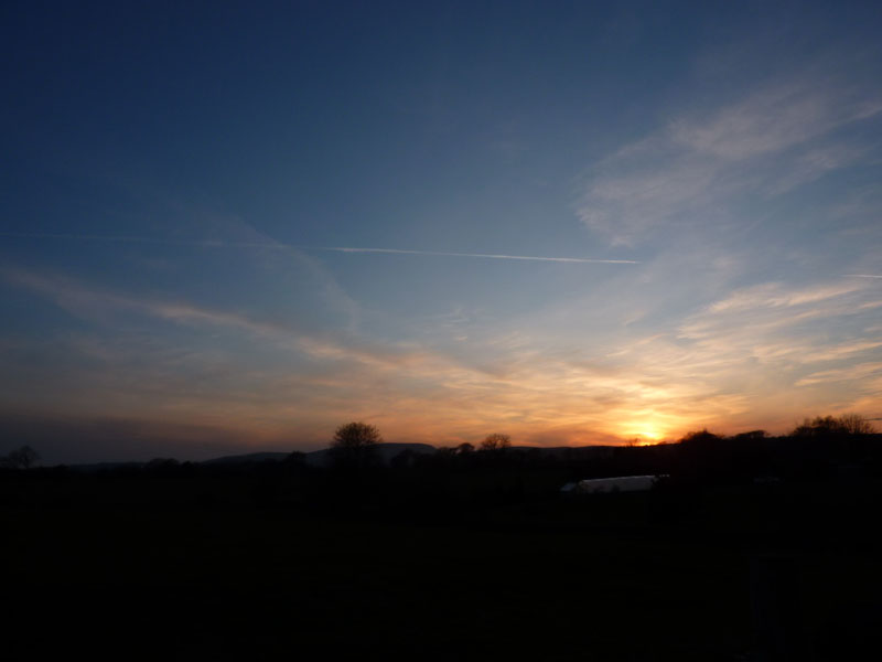
Pendle Sunset
More a sky shot than a landscape. I am now at Noyna Hall, the last of the "Noynas" on my route. From here, and this is only of use to folk who know the area, it was down Cockhill Lane and across the fields to Keighley Road. Along the road, past the old Hartley Hospital and Moor View (Hi to Jeffrey and Dorothy!) to Laneshawbridge and the car.
Walkers: Just Me
Time taken: 2hrs 10 minutes over a distance of approx. 5 miles.
Route: Laneshawbridge, Shaw Gate, Flass Bent, Great Edge, Noyna End, Noyna Hill, Noyna Bottom, Noyna Hall, Cockhill Road, Keighley Road, Laneshawbridge.
Weather and conditions: Clear skies, evening sunshine.
Greetings Count: Nil! Apart from the friendly farmer.
Richard's Refreshment Review: Nothing to report today.
All photos copyright Richard Ratcliffe 2010 ©
Take me back to the start ....